Dunsborough retiree Ian Wiese is a keen photographer in the Cape Naturaliste region.
In 2018 Ian re-discovered the remains of an unidentified 19th century shipwreck at Sandpatches surf break located between Sugarloaf Rock and Windmills surf break at Cape Naturaliste.
These are Ian’s comments and images: –
The fact that the name of the ship is unknown may seem unusual in these days of worldwide communications. However in 1887 there was no telegraph or other communications. European (and American whalers) would set out from their home port in their hundreds. In Western Australia their arrival was probably the first inkling local authorities had that they were coming. When a ship hadn’t returned to its home port after a few years alarm bells might ring in the home port, but it would be perhaps another year before they would write the ship off. So when a wreck washed up in SW Western Australia there was no way to know its identity.
There was a report on a shipwreck in the Daily News Sept 29th 1887 from a Busselton correspondent. (Source WA Museum).
This is an extract of the Daily News report by Busselton correspondent dated 24th September 1887.
“We have experienced some very rough weather since my last although it has somewhat moderated these last few days. The rain does not appear to have eased, and on the evening of the 13th it blew a regular gale and continued so for several days. The non-arrival of the S.S. Rob Roy, from Albany, caused some uneasiness. It was a great relief when she was telegraphed as having returned to Albany. To make matters look worse it was reported that a portion of a wrecked vessel had washed ashore near Capo Naturaliste. P.C, Sutton was dispatched to the scene of the reported wreck and returned on the Saturday evening, giving it as his opinion that it was a portion of one of the wrecks from the Hamelin that he had seen. As there appeared to be some doubt as to the correctness of this surmise he was ordered out again and returned to-day, bringing some pieces of the wood. He states that the wreck is ashore at Castle Rock and is about 40 foot long and 30 wide. The timbers are about 12×11, the planking 10×7. Sutton had some difficulty in getting on to the wreckage, and states that he was unable to find, any name or mark upon it. I have not yet heard what decision has been arrived at as to whether the wood brought in corresponds with the wood of any of the wrecked vessels at Augusta and Hamelin”.
So putting the Capes of Sunset report (Source: 2012 Capes of Sunset: Western Australia’s maritime heritage between Peel Inlet and Flinders Bay, Australian National Centre for Excellence for Maritime Archaeology Special Publication No. 15) and this together, Sutton made three trips in total out to Sugarloaf, presumably on horseback from Busselton. (He must have got it wrong about Castle Rock). On the last trip with James Armstrong he set fire to the wreck to stop people scavenging it!
The Capes of Sunset report says he went out on the 23rd Sept to investigate, and the Daily News says he was ordered out on a second trip, returning “today” (24th). His third trip (later that month) he burnt the wreck. The museum think that was to make it easier to extract the copper (illegal!).
There are also reports in the local papers of ships passing floating wreckage 500 miles SW of Cape Leeuwin in the weeks leading up to it washing ashore at Sugarloaf. The ship was a steel framed construction and wooden planked. The portion that washed up was about half the full ship. There are unconfirmed reports similar wreckage washed up just north of Redgate.
The wreckage can only be seen for a limited time each year. In winter the sand has been eroded and the wreckage may be visible. Over summer, the sand builds up and usually by late January it is all covered. The time this happens varies greatly each year. So maybe its visible October, November, December and even January. I have spoken to people who have snorkeled the area in October on a very very calm day and at that time other things like cutlery are exposed on the seabed.
The wreck is protected as it is more than 100 years old.
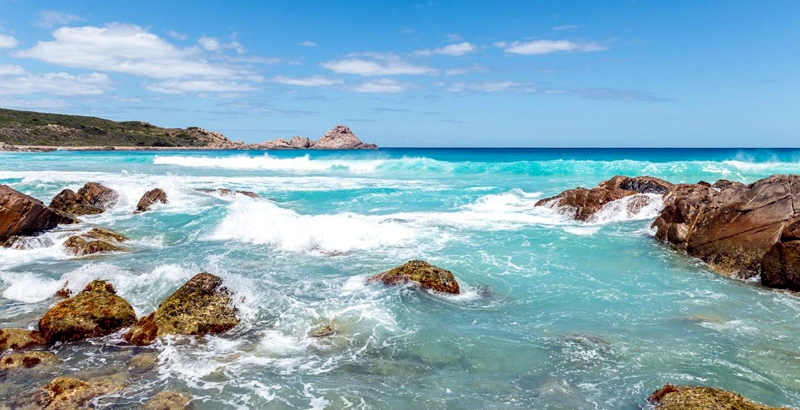
Image #1: This shipwreck was just to the right of where this photo was taken from. Sugarloaf Rock in the distance.

Image #2: Metal frames from the shipwreck.

Image #3: Metal frame from the shipwreck.

Image #4: Metal bolts from the shipwreck.

I know of two more shipwrecks in the Cape Naturaliste region – One is at Quindalup half way between Dunn Bay Rd and Elmore Rd in shallow water….this is more a boat than a ship, but it is still there!
The other is the Electra 1904 north of Shelly Cove Bunker Bay in 12-15m of water (the masts were sticking out of the water at high tide the next day). All got safely ashore.
Also there were the two shipping containers that fell off a ship in a storm off Cape Naturaliste around the mid 80’s. That is an interesting tale – One container came ashore at the southern end of Sandpatches. It was full of tobacco leaves (but the story grew and one version had it full of whisky). The tobacco version of the story comes from someone who saw it! The other container was full of color TVs and it came ashore just under the whale lookout near Cape Naturaliste. It seems half of Dunsborough helped themselves to a color TV lugging them back up the cliffs only to find salt water and electronics don’t mix!
GEOGRAPHE BAY WRECKS AND SHIPPING INCIDENTS brochure images courtesy of the WA Museum.
Image #5. GEOGRAPHE BAY WRECKS AND SHIPPING INCIDENTS brochure (page 1).

Image #6. GEOGRAPHE BAY WRECKS AND SHIPPING INCIDENTS brochure (page 2).

Thanks Ian for sharing your shipwreck research and images.
Click on this link to view or purchase Ian’s prints Ian Wiese’s Photography blog.
———————————————————-
Like this:
Like Loading...
Dunsborough retiree Ian Wiese is a keen photographer in the Cape Naturaliste region.
In 2018 Ian re-discovered the remains of an unidentified 19th century shipwreck at Sandpatches surf break located between Sugarloaf Rock and Windmills surf break at Cape Naturaliste.
These are Ian’s comments and images: –
The fact that the name of the ship is unknown may seem unusual in these days of worldwide communications. However in 1887 there was no telegraph or other communications. European (and American whalers) would set out from their home port in their hundreds. In Western Australia their arrival was probably the first inkling local authorities had that they were coming. When a ship hadn’t returned to its home port after a few years alarm bells might ring in the home port, but it would be perhaps another year before they would write the ship off. So when a wreck washed up in SW Western Australia there was no way to know its identity.
There was a report on a shipwreck in the Daily News Sept 29th 1887 from a Busselton correspondent. (Source WA Museum).
This is an extract of the Daily News report by Busselton correspondent dated 24th September 1887.
“We have experienced some very rough weather since my last although it has somewhat moderated these last few days. The rain does not appear to have eased, and on the evening of the 13th it blew a regular gale and continued so for several days. The non-arrival of the S.S. Rob Roy, from Albany, caused some uneasiness. It was a great relief when she was telegraphed as having returned to Albany. To make matters look worse it was reported that a portion of a wrecked vessel had washed ashore near Capo Naturaliste. P.C, Sutton was dispatched to the scene of the reported wreck and returned on the Saturday evening, giving it as his opinion that it was a portion of one of the wrecks from the Hamelin that he had seen. As there appeared to be some doubt as to the correctness of this surmise he was ordered out again and returned to-day, bringing some pieces of the wood. He states that the wreck is ashore at Castle Rock and is about 40 foot long and 30 wide. The timbers are about 12×11, the planking 10×7. Sutton had some difficulty in getting on to the wreckage, and states that he was unable to find, any name or mark upon it. I have not yet heard what decision has been arrived at as to whether the wood brought in corresponds with the wood of any of the wrecked vessels at Augusta and Hamelin”.
So putting the Capes of Sunset report (Source: 2012 Capes of Sunset: Western Australia’s maritime heritage between Peel Inlet and Flinders Bay, Australian National Centre for Excellence for Maritime Archaeology Special Publication No. 15) and this together, Sutton made three trips in total out to Sugarloaf, presumably on horseback from Busselton. (He must have got it wrong about Castle Rock). On the last trip with James Armstrong he set fire to the wreck to stop people scavenging it!
The Capes of Sunset report says he went out on the 23rd Sept to investigate, and the Daily News says he was ordered out on a second trip, returning “today” (24th). His third trip (later that month) he burnt the wreck. The museum think that was to make it easier to extract the copper (illegal!).
There are also reports in the local papers of ships passing floating wreckage 500 miles SW of Cape Leeuwin in the weeks leading up to it washing ashore at Sugarloaf. The ship was a steel framed construction and wooden planked. The portion that washed up was about half the full ship. There are unconfirmed reports similar wreckage washed up just north of Redgate.
The wreckage can only be seen for a limited time each year. In winter the sand has been eroded and the wreckage may be visible. Over summer, the sand builds up and usually by late January it is all covered. The time this happens varies greatly each year. So maybe its visible October, November, December and even January. I have spoken to people who have snorkeled the area in October on a very very calm day and at that time other things like cutlery are exposed on the seabed.
The wreck is protected as it is more than 100 years old.
Image #1: This shipwreck was just to the right of where this photo was taken from. Sugarloaf Rock in the distance.
Image #2: Metal frames from the shipwreck.
Image #3: Metal frame from the shipwreck.
Image #4: Metal bolts from the shipwreck.
I know of two more shipwrecks in the Cape Naturaliste region – One is at Quindalup half way between Dunn Bay Rd and Elmore Rd in shallow water….this is more a boat than a ship, but it is still there!
The other is the Electra 1904 north of Shelly Cove Bunker Bay in 12-15m of water (the masts were sticking out of the water at high tide the next day). All got safely ashore.
Also there were the two shipping containers that fell off a ship in a storm off Cape Naturaliste around the mid 80’s. That is an interesting tale – One container came ashore at the southern end of Sandpatches. It was full of tobacco leaves (but the story grew and one version had it full of whisky). The tobacco version of the story comes from someone who saw it! The other container was full of color TVs and it came ashore just under the whale lookout near Cape Naturaliste. It seems half of Dunsborough helped themselves to a color TV lugging them back up the cliffs only to find salt water and electronics don’t mix!
GEOGRAPHE BAY WRECKS AND SHIPPING INCIDENTS brochure images courtesy of the WA Museum.
Image #5. GEOGRAPHE BAY WRECKS AND SHIPPING INCIDENTS brochure (page 1).
Image #6. GEOGRAPHE BAY WRECKS AND SHIPPING INCIDENTS brochure (page 2).
Thanks Ian for sharing your shipwreck research and images.
Click on this link to view or purchase Ian’s prints Ian Wiese’s Photography blog.
———————————————————-
Share this:
Like this: